
Laplae District topographic map
Interactive map
Click on the map to display elevation.
About this map
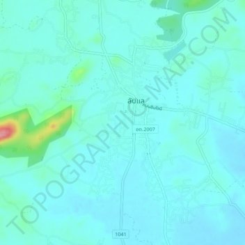
Name: Laplae District topographic map, elevation, terrain.
Location: Laplae District, Uttaradit Province, 53210, Thailand (17.62905 100.01764 17.66905 100.05764)
Average elevation: 84 m
Minimum elevation: 69 m
Maximum elevation: 181 m
Other topographic maps
Click on a map to view its topography, its elevation and its terrain.