
Leudelange topographic map
Interactive map
Click on the map to display elevation.
About this map
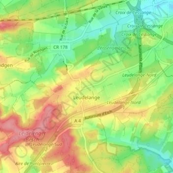
Name: Leudelange topographic map, elevation, terrain.
Location: Leudelange, Canton Esch-sur-Alzette, Luxembourg (49.54771 6.03740 49.58982 6.10435)
Average elevation: 312 m
Minimum elevation: 270 m
Maximum elevation: 361 m