Geolocate

Chipman topographic map

Click on the map to display elevation.

About this map

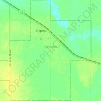
Name: Chipman topographic map, elevation, terrain.

Location: Chipman, Alberta, T0B 0W0, Canada (53.67259 -112.66864 53.70903 -112.60647)

Average elevation: 670 m

Minimum elevation: 660 m

Maximum elevation: 679 m

Gear up for your next adventure:

🌂Windproof Trekking Umbrellas - Surprising but effective rain protection on low-wind trails
🌄Compact Monoculars - Lightweight optics for hiking
🦟Anti-Midge & Tick Repellent - Vital for hiking in the Scottish Highlands during summer
🍱Food Containers - Reusable containers for outdoor meals
🛌Sleeping Mats - Insulated mats for comfortable outdoor sleeping

As an Amazon Associate, this site earns from qualifying purchases at no extra cost to you.