
Liquiñe topographic map
Interactive map
Click on the map to display elevation.
About this map
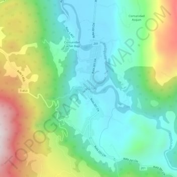
Name: Liquiñe topographic map, elevation, terrain.
Average elevation: 495 m
Minimum elevation: 217 m
Maximum elevation: 1,100 m
Other topographic maps
Click on a map to view its topography, its elevation and its terrain.
Puerto Fuy
Chile > Región de Los Ríos > Provincia de Valdivia > Panguipulli
Puerto Fuy, Panguipulli, Provincia de Valdivia, Región de Los Ríos, Chile
Average elevation: 686 m