
Thank you for supporting this site ❤️
Make a donation
Make a donation
Gear up for your next adventure:
As an Amazon Associate, this site earns from qualifying purchases at no extra cost to you.
Tamborrel topographic map
Click on the map to display elevation.
Thank you for supporting this site ❤️
Make a donation
Make a donation
Gear up for your next adventure:
As an Amazon Associate, this site earns from qualifying purchases at no extra cost to you.
About this map
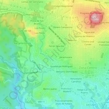
Name: Tamborrel topographic map, elevation, terrain.
Location: Tamborrel, Xalapa-Enríquez, Xalapa, Veracruz, 91026, México (19.51469 -96.95628 19.55469 -96.91628)
Average elevation: 1,408 m
Minimum elevation: 1,320 m
Maximum elevation: 1,577 m
Thank you for supporting this site ❤️
Make a donation
Make a donation
Gear up for your next adventure:
As an Amazon Associate, this site earns from qualifying purchases at no extra cost to you.
Other topographic maps
Click on a map to view its topography, its elevation and its terrain.
Parque Ecológico El Haya
México > Veracruz > Xalapa > Xalapa-Enríquez > Benito Juárez
Average elevation: 1,360 m