
قاباخ topographic map
Interactive map
Click on the map to display elevation.
About this map
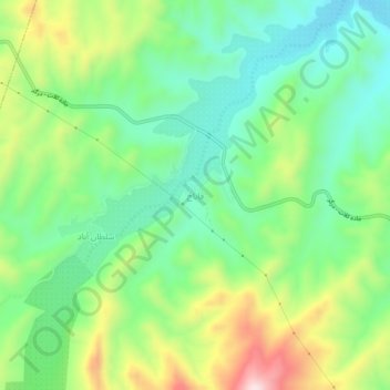
Name: قاباخ topographic map, elevation, terrain.
Average elevation: 869 m
Minimum elevation: 719 m
Maximum elevation: 1,151 m
Other topographic maps
Click on a map to view its topography, its elevation and its terrain.
Kalat
Iran > Razavi Khorasan > Kalat County > Kalat City
Kalat, Kalat City, Markazi District of Kalat County, Kalat County, Razavi Khorasan, Iran
Average elevation: 1,063 m