
Thank you for supporting this site ❤️
Make a donation
Make a donation
Gear up for your next adventure:
As an Amazon Associate, this site earns from qualifying purchases at no extra cost to you.
Annagry topographic map
Click on the map to display elevation.
Thank you for supporting this site ❤️
Make a donation
Make a donation
Gear up for your next adventure:
As an Amazon Associate, this site earns from qualifying purchases at no extra cost to you.
About this map
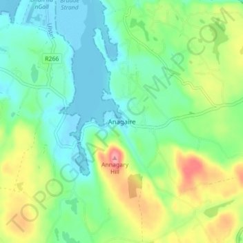
Name: Annagry topographic map, elevation, terrain.
Location: Annagry, Glenties Municipal District, County Donegal, Ireland (55.00167 -8.33784 55.04167 -8.29784)
Average elevation: 32 m
Minimum elevation: -4 m
Maximum elevation: 98 m
Thank you for supporting this site ❤️
Make a donation
Make a donation
Gear up for your next adventure:
As an Amazon Associate, this site earns from qualifying purchases at no extra cost to you.