
Kleinkahl topographic map
Interactive map
Click on the map to display elevation.
About this map
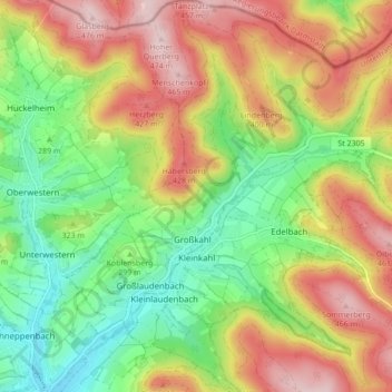
Name: Kleinkahl topographic map, elevation, terrain.
Average elevation: 330 m
Minimum elevation: 205 m
Maximum elevation: 481 m
Kleinkahl liegt in der Region Bayerischer Untermain am westlichen Rande des Spessarts im oberen Kahlgrund. Der topographisch höchste Punkt der Gemeinde befindet sich am Gipfel des Lindenberges 463 m ü. NHN (Lage)50.141859.28004, der niedrigste liegt an der Kahl auf 215 m ü. NHN (Lage)50.096879.26126.