
Chettia topographic map
Interactive map
Click on the map to display elevation.
About this map
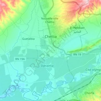
Name: Chettia topographic map, elevation, terrain.
Location: Chettia, Ouled Fares District, Chlef, Algeria (36.12797 1.20353 36.22959 1.29612)
Average elevation: 124 m
Minimum elevation: 71 m
Maximum elevation: 352 m