
El Attaf topographic map
Interactive map
Click on the map to display elevation.
About this map
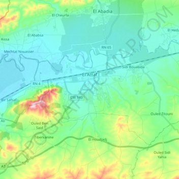
Name: El Attaf topographic map, elevation, terrain.
Location: El Attaf, El Attaf District, Aïn Defla, Algeria (36.16849 1.61780 36.25624 1.79457)
Average elevation: 229 m
Minimum elevation: 142 m
Maximum elevation: 535 m