
Peter Sinks topographic map
Interactive map
Click on the map to display elevation.
About this map
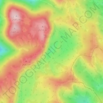
Name: Peter Sinks topographic map, elevation, terrain.
Location: Peter Sinks, Cache County, Utah, Estados Unidos da América (41.91247 -111.51880 41.91257 -111.51870)
Average elevation: 2,555 m
Minimum elevation: 2,403 m
Maximum elevation: 2,675 m