
Thank you for supporting this site ❤️
Make a donation
Make a donation
Gear up for your next adventure:
As an Amazon Associate, this site earns from qualifying purchases at no extra cost to you.
Cannonville topographic map
Click on the map to display elevation.
Thank you for supporting this site ❤️
Make a donation
Make a donation
Gear up for your next adventure:
As an Amazon Associate, this site earns from qualifying purchases at no extra cost to you.
About this map
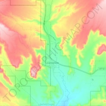
Name: Cannonville topographic map, elevation, terrain.
Location: Cannonville, Garfield County, Utah, 84718, United States (37.53580 -112.06499 37.61193 -112.03823)
Average elevation: 1,894 m
Minimum elevation: 1,743 m
Maximum elevation: 2,071 m
Thank you for supporting this site ❤️
Make a donation
Make a donation
Gear up for your next adventure:
As an Amazon Associate, this site earns from qualifying purchases at no extra cost to you.