
Rüdersdorf bei Berlin topographic map
Interactive map
Click on the map to display elevation.
About this map
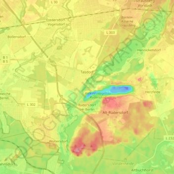
Name: Rüdersdorf bei Berlin topographic map, elevation, terrain.
Average elevation: 51 m
Minimum elevation: -38 m
Maximum elevation: 102 m
Dazu kommen die Wohnplätze Alt Rüdersdorf, Alte Grund, Bergbrück, Berghof, Bergmannsglück, Franz-Künstler-Siedlung, Grünelinde, Hortwinkel, Landhof, Lichtenow Dorf, Rüdersdorfer Grund, Schulzenhöhe, Seebad Rüdersdorf und Tasdorf.