
Osrednja grapa topographic map
Interactive map
Click on the map to display elevation.
About this map
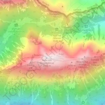
Name: Osrednja grapa topographic map, elevation, terrain.
Location: Osrednja grapa, Žirovnica, Slovenia (46.42209 14.23160 46.42399 14.23228)
Average elevation: 1,563 m
Minimum elevation: 1,109 m
Maximum elevation: 2,034 m