
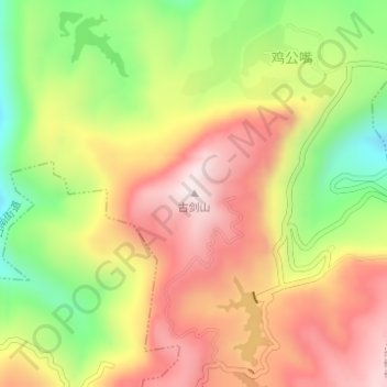
古剑山 topographic map
Interactive map
Click on the map to display elevation.
About this map
Name: 古剑山 topographic map, elevation, terrain.
Location: 古剑山, 古南街道, 綦江区, 重庆市主城都市区, 重庆市, 中国 (28.96650 106.60128 28.96660 106.60138)
Average elevation: 857 m
Minimum elevation: 561 m
Maximum elevation: 1,116 m
Other topographic maps
Click on a map to view its topography, its elevation and its terrain.