
Nayagarh Sadar topographic map
Interactive map
Click on the map to display elevation.
About this map
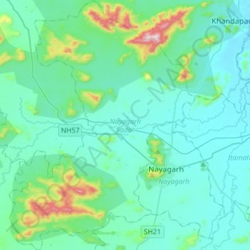
Name: Nayagarh Sadar topographic map, elevation, terrain.
Location: Nayagarh Sadar, Nayagarh, Odisha, India (20.05269 84.95075 20.28239 85.13254)
Average elevation: 146 m
Minimum elevation: 51 m
Maximum elevation: 725 m