
IJssel topographic map
Interactive map
Click on the map to display elevation.
About this map
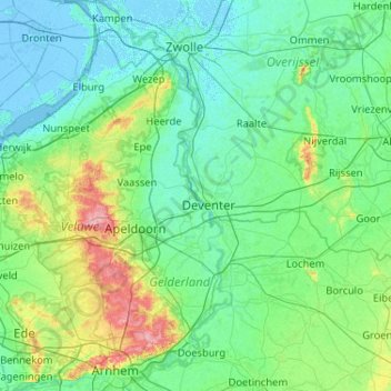
Name: IJssel topographic map, elevation, terrain.
Location: IJssel, Deventer, Oberyssel, Niederlande, 6827 BG, Niederlande (51.95135 5.77773 52.58385 6.21873)
Average elevation: 16 m
Minimum elevation: -6 m
Maximum elevation: 109 m