
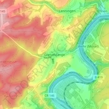
Greiveldange topographic map
Interactive map
Click on the map to display elevation.
About this map
Name: Greiveldange topographic map, elevation, terrain.
Location: Greiveldange, Stadtbredimus, Canton Remich, 5426, Luxembourg (49.56608 6.33958 49.60608 6.37958)
Average elevation: 211 m
Minimum elevation: 125 m
Maximum elevation: 300 m