Geolocate

Lakeside topographic map

Click on the map to display elevation.

About this map

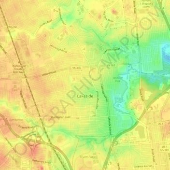
Name: Lakeside topographic map, elevation, terrain.

Location: Lakeside, Henrico County, Virginia, 23228, United States (37.58985 -77.50068 37.63397 -77.45513)

Average elevation: 57 m

Minimum elevation: 24 m

Maximum elevation: 76 m

Gear up for your next adventure:

🧰Survival Kits - Emergency tools for remote environments
🧺Mesh Stuff Sacks - Breathable storage for wet gear or camp organization
🧤Thermal Touchscreen Gloves - Stay warm while operating your GPS or smartphone camera
🌦️Portable Weather Meters - Handheld tools for monitoring weather conditions
🧴Sport Sunscreen Sticks - High-protection sunblock that won't run into your eyes on the trail

As an Amazon Associate, this site earns from qualifying purchases at no extra cost to you.