Geolocate

Peddapalli topographic map

Click on the map to display elevation.

About this map

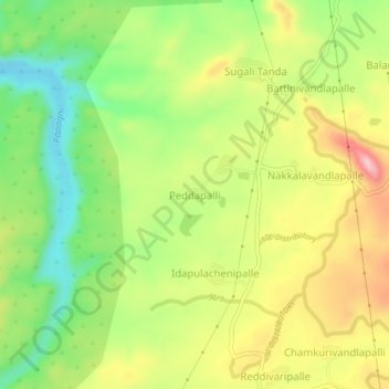
Name: Peddapalli topographic map, elevation, terrain.

Location: Peddapalli, Galiveedu, Annamayya, Andhra Pradesh, India (14.07993 78.49248 14.11993 78.53248)

Average elevation: 377 m

Minimum elevation: 281 m

Maximum elevation: 488 m

Gear up for your next adventure:

Insulated Travel Mugs - Keep drinks hot while surveying the landscape from a summit
🗺️Scratch-off Peak Maps - Track your progress climbing Munros or Wainwrights
🧗Locking Carabiners - Secure gear to your pack or for light technical use
🌂Windproof Trekking Umbrellas - Surprising but effective rain protection on low-wind trails
🔋Solar Chargers - Eco-friendly charging solutions for outdoor use

As an Amazon Associate, this site earns from qualifying purchases at no extra cost to you.