Geolocate

Metta topographic map

Click on the map to display elevation.

About this map

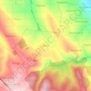
Name: Metta topographic map, elevation, terrain.

Location: Metta, Mau Narok ward, Njoro, Nakuru, Rift Valley, Kenya (-0.60437 36.00864 -0.56437 36.04864)

Average elevation: 2,546 m

Minimum elevation: 2,339 m

Maximum elevation: 2,690 m

Gear up for your next adventure:

🧣Neck Gaiters - Protects against wind and sun on exposed ridges and peaks
🎒Hiking Child Carriers - Explore the outdoors with the whole family safely
🎒Hiking Daypacks - Compact backpacks ideal for short hikes and excursions
📢Survival Whistles - Essential safety gear for signaling for help in mountain fog
🔦Outdoor Torches - Reliable torches for night navigation

As an Amazon Associate, this site earns from qualifying purchases at no extra cost to you.