
Neuberend topographic map
Interactive map
Click on the map to display elevation.
About this map
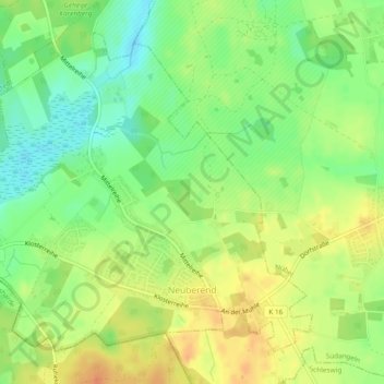
Name: Neuberend topographic map, elevation, terrain.
Average elevation: 34 m
Minimum elevation: 14 m
Maximum elevation: 52 m
Other topographic maps
Click on a map to view its topography, its elevation and its terrain.
Altholzkrug
Deutschland > Schleswig-Holstein > Schleswig-Flensburg > Handewitt
Altholzkrug, Handewitt, Schleswig-Flensburg, Schleswig-Holstein, 24941, Deutschland
Average elevation: 40 m
Schleswig
Deutschland > Schleswig-Holstein > Schleswig-Flensburg
Schleswig, Schleswig-Flensburg, Schleswig-Holstein, 24837, Deutschland
Average elevation: 22 m