
Thank you for supporting this site ❤️
Make a donation
Make a donation
Gear up for your next adventure:
As an Amazon Associate, this site earns from qualifying purchases at no extra cost to you.
Kotma topographic map
Click on the map to display elevation.
Thank you for supporting this site ❤️
Make a donation
Make a donation
Gear up for your next adventure:
As an Amazon Associate, this site earns from qualifying purchases at no extra cost to you.
About this map
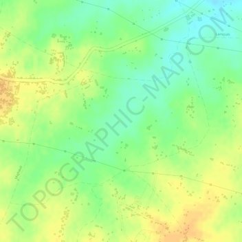
Name: Kotma topographic map, elevation, terrain.
Location: Kotma, Majhauli Tahsil, Sidhi District, Madhya Pradesh, India (24.10526 81.63149 24.12402 81.65585)
Average elevation: 370 m
Minimum elevation: 351 m
Maximum elevation: 384 m
Thank you for supporting this site ❤️
Make a donation
Make a donation
Gear up for your next adventure:
As an Amazon Associate, this site earns from qualifying purchases at no extra cost to you.