
Pakihi Island (Sandspit Island) topographic map
Interactive map
Click on the map to display elevation.
About this map
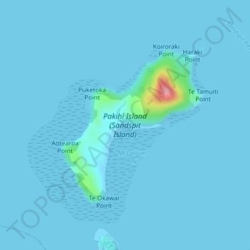
Name: Pakihi Island (Sandspit Island) topographic map, elevation, terrain.
Average elevation: 4 m
Minimum elevation: -1 m
Maximum elevation: 117 m
Other topographic maps
Click on a map to view its topography, its elevation and its terrain.
Sandy Bay Island
New Zealand > Auckland > Waiheke
Sandy Bay Island, Waiheke, Auckland, New Zealand
Average elevation: 5 m
Waiheke Island
New Zealand > Auckland > Waiheke
Waiheke Island, Waiheke, Auckland, New Zealand
Average elevation: 16 m