
Rio Jalan topographic map
Interactive map
Click on the map to display elevation.
About this map
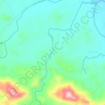
Name: Rio Jalan topographic map, elevation, terrain.
Location: Rio Jalan, Jutiapa, Atlántida, Honduras (15.64467 -86.52373 15.68754 -86.49356)
Average elevation: 168 m
Minimum elevation: 82 m
Maximum elevation: 439 m
Other topographic maps
Click on a map to view its topography, its elevation and its terrain.