
Nguti topographic map
Interactive map
Click on the map to display elevation.
About this map
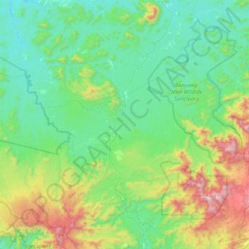
Name: Nguti topographic map, elevation, terrain.
Location: Nguti, Kupe-Muanenguba, Southwest, Cameroon (5.01451 9.18044 5.49002 9.90712)
Average elevation: 490 m
Minimum elevation: 97 m
Maximum elevation: 1,966 m
Other topographic maps
Click on a map to view its topography, its elevation and its terrain.
Lake Bermin
Cameroon > Southwest > Kupe-Muanenguba > Nguti
Lake Bermin, Nguti, Kupe-Muanenguba, Southwest, Cameroon
Average elevation: 494 m
Mount Manenguba
Cameroon > Southwest > Kupe-Muanenguba > Bangem
Mount Manenguba, Bangem, Kupe-Muanenguba, Southwest, Cameroon
Average elevation: 2,112 m