Geolocate

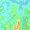
Barroca topographic map

Click on the map to display elevation.

About this map

Name: Barroca topographic map, elevation, terrain.

Location: Barroca, Regional Oeste, Belo Horizonte, Minas Gerais, Região Sudeste, Brasil (-19.93562 -43.96693 -19.93038 -43.96124)

Average elevation: 900 m

Minimum elevation: 845 m

Maximum elevation: 1,007 m

Other topographic maps

Click on a map to view its topography, its elevation and its terrain.

Itamarati

Brasil > Minas Gerais > Belo Horizonte > Pampulha

Average elevation: 831 m

Serra do Curral

Brasil > Minas Gerais > Belo Horizonte

Average elevation: 1,115 m

Gear up for your next adventure:

🧴Tick Removal Tools - Small, essential health tool for UK woodland and moorland
🚲Cycling GPS Computers - Track elevation and topographic routes on two wheels
🎿Telescopic Trekking Poles - Reduces knee strain on steep topographic descents
👟Men's Trail Running Shoes - Lightweight grip for fast movement over topographic contours
📢Survival Whistles - Essential safety gear for signaling for help in mountain fog

As an Amazon Associate, this site earns from qualifying purchases at no extra cost to you.