
Rialp topographic map
Interactive map
Click on the map to display elevation.
About this map
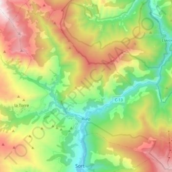
Name: Rialp topographic map, elevation, terrain.
Location: Rialp, Pallars Sobirà, Lerida, Catalonië, 25594, Spanje (42.40931 1.06677 42.52048 1.22332)
Average elevation: 1,449 m
Minimum elevation: 681 m
Maximum elevation: 2,589 m
Other topographic maps
Click on a map to view its topography, its elevation and its terrain.