Geolocate

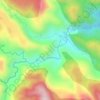
Can-untog topographic map

Click on the map to display elevation.

About this map

Name: Can-untog topographic map, elevation, terrain.

Location: Can-untog, Ormoc, Leyte, Eastern Visayas, Philippines (10.96158 124.63747 11.00158 124.67747)

Average elevation: 51 m

Minimum elevation: 0 m

Maximum elevation: 209 m

Other topographic maps

Click on a map to view its topography, its elevation and its terrain.
Binahaan River

Philippines > Leyte > Ormoc

Average elevation: 546 m

Binahaan River

Philippines > Leyte > Ormoc

Average elevation: 495 m

Ormoc City Proper

Philippines > Leyte > Ormoc

Average elevation: 18 m

Gear up for your next adventure:

⛺Lightweight Solo Tents - Backpacking tents designed for wild camping in the UK highlands
🔦Outdoor Torches - Reliable torches for night navigation
🐕Hiking Dog Harnesses - Rugged harnesses for taking your companion on mountain trails
🎒Backpack Rain Covers - Universal waterproof covers to protect your gear from downpours
🧗Locking Carabiners - Secure gear to your pack or for light technical use

As an Amazon Associate, this site earns from qualifying purchases at no extra cost to you.