
Blausee-Mitholz topographic map
Interactive map
Click on the map to display elevation.
About this map
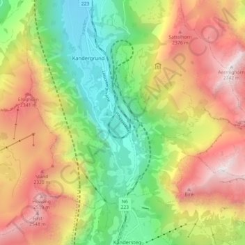
Name: Blausee-Mitholz topographic map, elevation, terrain.
Average elevation: 1,687 m
Minimum elevation: 806 m
Maximum elevation: 2,727 m
Other topographic maps
Click on a map to view its topography, its elevation and its terrain.
Blausee
Zwitserland > Bern/Berne > Verwaltungskreis Frutigen-Niedersimmental > Kandergrund > Blausee-Mitholz
Blausee, Blausee-Mitholz, Kandergrund, Verwaltungskreis Frutigen-Niedersimmental, Verwaltungsregion Oberland, Bern/Berne, 3717, Zwitserland
Average elevation: 1,266 m