
Majenang topographic map
Interactive map
Click on the map to display elevation.
About this map
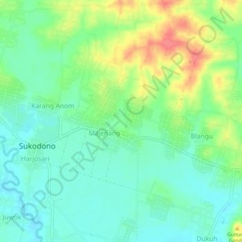
Name: Majenang topographic map, elevation, terrain.
Location: Majenang, Sragen, Central Java, Indonesia (-7.34534 110.95513 -7.30534 110.99513)
Average elevation: 100 m
Minimum elevation: 78 m
Maximum elevation: 143 m
Other topographic maps
Click on a map to view its topography, its elevation and its terrain.
Kedawung
Indonesia > Central Java > Sragen
Kedawung, Sragen, Central Java, Java, Indonesia
Average elevation: 162 m
Krebet
Indonesia > Central Java > Sragen
Krebet, Sragen, Central Java, Java, Indonesia
Average elevation: 103 m