
Fort Saskatchewan topographic map
Interactive map
Click on the map to display elevation.
About this map
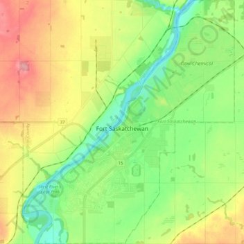
Name: Fort Saskatchewan topographic map, elevation, terrain.
Location: Fort Saskatchewan, Alberta, Canada (53.65751 -113.29427 53.77426 -113.12414)
Average elevation: 635 m
Minimum elevation: 595 m
Maximum elevation: 689 m
Other topographic maps
Click on a map to view its topography, its elevation and its terrain.
Fort Saskatchewan
Canada > Alberta > Fort Saskatchewan
Fort Saskatchewan, Alberta, T8L 1Y8, Canada
Average elevation: 662 m