
Piñera topographic map
Interactive map
Click on the map to display elevation.
About this map
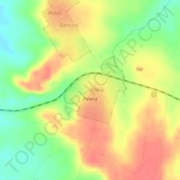
Name: Piñera topographic map, elevation, terrain.
Location: Piñera, Paysandú, 60010, Uruguay (-32.33341 -57.05341 -32.32320 -57.04225)
Average elevation: 138 m
Minimum elevation: 105 m
Maximum elevation: 164 m