
Hagen topographic map
Interactive map
Click on the map to display elevation.
About this map
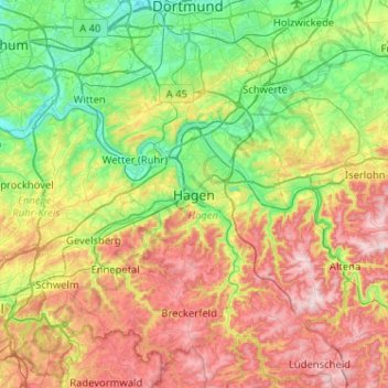
Name: Hagen topographic map, elevation, terrain.
Location: Hagen, Nordrhein-Westfalen, 58095, Deutschland (51.19829 7.31330 51.51829 7.63330)
Average elevation: 229 m
Minimum elevation: 62 m
Maximum elevation: 508 m
Der Höhenunterschied vom tiefsten Punkt an der Ruhr bei Vorhalle (86 m ü. NN) zum höchsten Punkt östlich von Bölling (438 m ü. NN) 7°33'48" E, 51°17'30" N beträgt 352 m.
Other topographic maps
Click on a map to view its topography, its elevation and its terrain.
Krähnocken
Deutschland > Nordrhein-Westfalen > Hagen > Krähnocken
Krähnocken, Eilpe/Dahl, Hagen, Nordrhein-Westfalen, 58095, Deutschland
Average elevation: 208 m