
Thank you for supporting this site ❤️
Make a donation
Make a donation
Gear up for your next adventure:
As an Amazon Associate, this site earns from qualifying purchases at no extra cost to you.
Monsaraz topographic map
Click on the map to display elevation.
Thank you for supporting this site ❤️
Make a donation
Make a donation
Gear up for your next adventure:
As an Amazon Associate, this site earns from qualifying purchases at no extra cost to you.
About this map
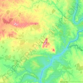
Name: Monsaraz topographic map, elevation, terrain.
Location: Monsaraz, Reguengos de Monsaraz, Évora, Portugal (38.37970 -7.44054 38.51180 -7.33786)
Average elevation: 180 m
Minimum elevation: 104 m
Maximum elevation: 325 m
Thank you for supporting this site ❤️
Make a donation
Make a donation
Gear up for your next adventure:
As an Amazon Associate, this site earns from qualifying purchases at no extra cost to you.