
Thank you for supporting this site ❤️
Make a donation
Make a donation
Gear up for your next adventure:
As an Amazon Associate, this site earns from qualifying purchases at no extra cost to you.
Anabanua topographic map
Click on the map to display elevation.
Thank you for supporting this site ❤️
Make a donation
Make a donation
Gear up for your next adventure:
As an Amazon Associate, this site earns from qualifying purchases at no extra cost to you.
About this map
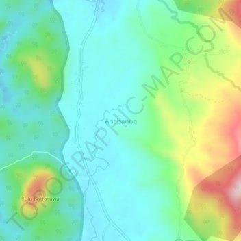
Name: Anabanua topographic map, elevation, terrain.
Location: Anabanua, Barru, South Sulawesi, Sulawesi, 90711, Indonesia (-4.49654 119.70253 -4.45654 119.74253)
Average elevation: 191 m
Minimum elevation: 86 m
Maximum elevation: 468 m
Thank you for supporting this site ❤️
Make a donation
Make a donation
Gear up for your next adventure:
As an Amazon Associate, this site earns from qualifying purchases at no extra cost to you.