
Ambalavayal topographic map
Interactive map
Click on the map to display elevation.
About this map
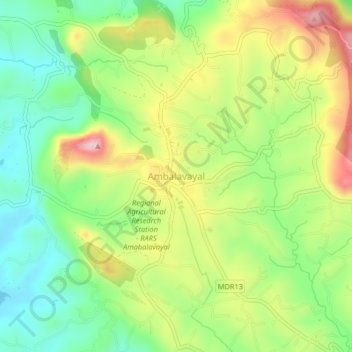
Name: Ambalavayal topographic map, elevation, terrain.
Location: Ambalavayal, Sulthanbathery, Wayanad, Kerala, 673593, India (11.59920 76.19202 11.63920 76.23202)
Average elevation: 880 m
Minimum elevation: 759 m
Maximum elevation: 1,052 m