
Horeston Grange topographic map
Interactive map
Click on the map to display elevation.
About this map
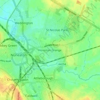
Name: Horeston Grange topographic map, elevation, terrain.
Average elevation: 90 m
Minimum elevation: 76 m
Maximum elevation: 110 m
Other topographic maps
Click on a map to view its topography, its elevation and its terrain.
Nuneaton
United Kingdom > England > Warwickshire > Nuneaton and Bedworth
Nuneaton, Nuneaton and Bedworth, Warwickshire, England, CV11 5AB, United Kingdom
Average elevation: 101 m
Nuneaton Common
United Kingdom > England > Warwickshire > Nuneaton and Bedworth
Nuneaton Common, Whittleford, Nuneaton and Bedworth, Warwickshire, England, United Kingdom
Average elevation: 127 m
Ash Green
United Kingdom > England > Warwickshire > Nuneaton and Bedworth > Ash Green
Ash Green, Nuneaton and Bedworth, Warwickshire, England, CV7 9AQ, United Kingdom
Average elevation: 111 m
Exhall
United Kingdom > England > Warwickshire > Nuneaton and Bedworth
Exhall, Nuneaton and Bedworth, Warwickshire, England, CV7 9DJ, United Kingdom
Average elevation: 101 m
Bedworth
United Kingdom > England > Warwickshire > Nuneaton and Bedworth
Bedworth, Nuneaton and Bedworth, Warwickshire, England, CV12 9DQ, United Kingdom
Average elevation: 105 m
Bulkington
United Kingdom > England > Warwickshire > Nuneaton and Bedworth
Bulkington, Nuneaton and Bedworth, Warwickshire, England, CV12 9NN, United Kingdom
Average elevation: 107 m