
Thank you for supporting this site ❤️
Make a donation
Make a donation
Gear up for your next adventure:
As an Amazon Associate, this site earns from qualifying purchases at no extra cost to you.
Bugnay topographic map
Click on the map to display elevation.
Thank you for supporting this site ❤️
Make a donation
Make a donation
Gear up for your next adventure:
As an Amazon Associate, this site earns from qualifying purchases at no extra cost to you.
About this map
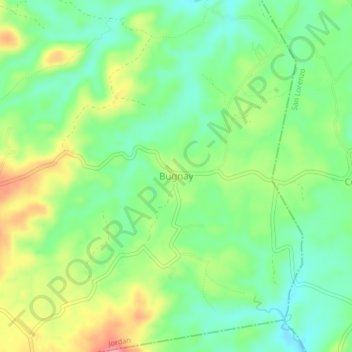
Name: Bugnay topographic map, elevation, terrain.
Location: Bugnay, Jordan, Guimaras, Western Visayas, 5047, Philippines (10.57361 122.60096 10.61361 122.64096)
Average elevation: 133 m
Minimum elevation: 94 m
Maximum elevation: 195 m
Thank you for supporting this site ❤️
Make a donation
Make a donation
Gear up for your next adventure:
As an Amazon Associate, this site earns from qualifying purchases at no extra cost to you.