
Thank you for supporting this site ❤️
Make a donation
Make a donation
Gear up for your next adventure:
As an Amazon Associate, this site earns from qualifying purchases at no extra cost to you.
Wölkisch topographic map
Click on the map to display elevation.
Thank you for supporting this site ❤️
Make a donation
Make a donation
Gear up for your next adventure:
As an Amazon Associate, this site earns from qualifying purchases at no extra cost to you.
About this map
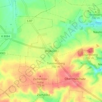
Name: Wölkisch topographic map, elevation, terrain.
Location: Wölkisch, Diera-Zehren, Meißen, Sachsen, 01665, Deutschland (51.20429 13.34085 51.24429 13.38085)
Average elevation: 147 m
Minimum elevation: 111 m
Maximum elevation: 182 m
Thank you for supporting this site ❤️
Make a donation
Make a donation
Gear up for your next adventure:
As an Amazon Associate, this site earns from qualifying purchases at no extra cost to you.