
Eferding topographic map
Interactive map
Click on the map to display elevation.
About this map
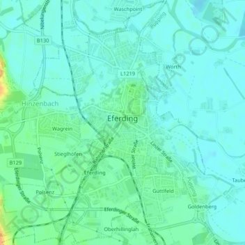
Name: Eferding topographic map, elevation, terrain.
Location: Eferding, Bezirk Eferding, 4070, Austria (48.29445 14.00557 48.32112 14.03414)
Average elevation: 268 m
Minimum elevation: 260 m
Maximum elevation: 294 m
Other topographic maps
Click on a map to view its topography, its elevation and its terrain.