
Thank you for supporting this site ❤️
Make a donation
Make a donation
Gear up for your next adventure:
As an Amazon Associate, this site earns from qualifying purchases at no extra cost to you.
Trezaise topographic map
Click on the map to display elevation.
Thank you for supporting this site ❤️
Make a donation
Make a donation
Gear up for your next adventure:
As an Amazon Associate, this site earns from qualifying purchases at no extra cost to you.
About this map
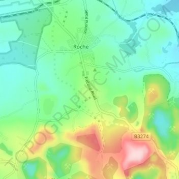
Name: Trezaise topographic map, elevation, terrain.
Location: Trezaise, Roche, Cornwall, England, PL26 8HP, United Kingdom (50.37760 -4.85019 50.41760 -4.81019)
Average elevation: 196 m
Minimum elevation: 124 m
Maximum elevation: 359 m
Cornwall trails, hiking, mountain biking, running and outdoor activities
Thank you for supporting this site ❤️
Make a donation
Make a donation
Gear up for your next adventure:
As an Amazon Associate, this site earns from qualifying purchases at no extra cost to you.