
Rocks Village topographic map
Interactive map
Click on the map to display elevation.
About this map
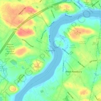
Name: Rocks Village topographic map, elevation, terrain.
Average elevation: 28 m
Minimum elevation: -6 m
Maximum elevation: 74 m
Other topographic maps
Click on a map to view its topography, its elevation and its terrain.
Haverhill
United States > Massachusetts > Essex County > Haverhill
Haverhill, Essex County, Massachusetts, 01830, United States
Average elevation: 45 m
Chadwick Pond
United States > Massachusetts > Essex County > Haverhill
Chadwick Pond, Haverhill, Essex County, Massachusetts, United States
Average elevation: 43 m