
Linares de Mora topographic map
Interactive map
Click on the map to display elevation.
About this map
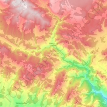
Name: Linares de Mora topographic map, elevation, terrain.
Location: Linares de Mora, Gúdar-Javalambre, Teruel, Aragon, Espagne (40.23178 -0.64234 40.38527 -0.49473)
Average elevation: 1,530 m
Minimum elevation: 865 m
Maximum elevation: 1,991 m
Other topographic maps
Click on a map to view its topography, its elevation and its terrain.
Albentosa
Espagne > Aragon > Gúdar-Javalambre
Albentosa, Gúdar-Javalambre, Teruel, Aragon, Espagne
Average elevation: 984 m
Las Matanzas
Espagne > Aragon > Gúdar-Javalambre > Rubielos de Mora
Las Matanzas, Rubielos de Mora, Gúdar-Javalambre, Teruel, Aragon, Espagne
Average elevation: 1,053 m