
Bukit Timah Nature Reserve topographic map
Interactive map
Click on the map to display elevation.
About this map
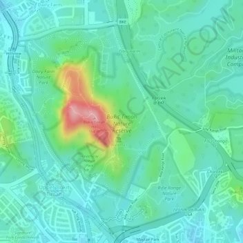
Name: Bukit Timah Nature Reserve topographic map, elevation, terrain.
Average elevation: 52 m
Minimum elevation: 14 m
Maximum elevation: 168 m
Other topographic maps
Click on a map to view its topography, its elevation and its terrain.
Bukit Timah Hill
Bukit Timah Hill, Northwest, 589333, Singapore
Average elevation: 52 m