
Booneville topographic map
Interactive map
Click on the map to display elevation.
About this map
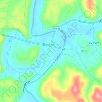
Name: Booneville topographic map, elevation, terrain.
Location: Booneville, Owsley County, Kentucky, États-Unis (37.46823 -83.69085 37.48078 -83.65976)
Average elevation: 238 m
Minimum elevation: 198 m
Maximum elevation: 336 m