
Le Wayai topographic map
Interactive map
Click on the map to display elevation.
About this map
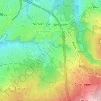
Name: Le Wayai topographic map, elevation, terrain.
Location: Le Wayai, Jalhay, Liège, Wallonie, 4845, Belgique (50.48687 5.91910 50.52687 5.95910)
Average elevation: 393 m
Minimum elevation: 305 m
Maximum elevation: 544 m