
Thank you for supporting this site ❤️
Make a donation
Make a donation
Gear up for your next adventure:
As an Amazon Associate, this site earns from qualifying purchases at no extra cost to you.
Mikese topographic map
Click on the map to display elevation.
Thank you for supporting this site ❤️
Make a donation
Make a donation
Gear up for your next adventure:
As an Amazon Associate, this site earns from qualifying purchases at no extra cost to you.
About this map
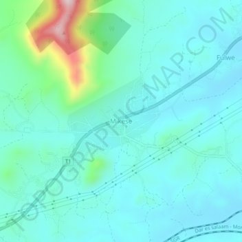
Name: Mikese topographic map, elevation, terrain.
Location: Mikese, Morogoro, Morogoro Region, Coastal Zone, Tanzania (-6.76978 37.85957 -6.72978 37.89957)
Average elevation: 447 m
Minimum elevation: 384 m
Maximum elevation: 745 m
Thank you for supporting this site ❤️
Make a donation
Make a donation
Gear up for your next adventure:
As an Amazon Associate, this site earns from qualifying purchases at no extra cost to you.