
El Ogla topographic map
Interactive map
Click on the map to display elevation.
About this map
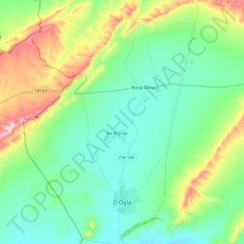
Name: El Ogla topographic map, elevation, terrain.
Location: El Ogla, El Ogla District, Tébessa, Algeria (35.16101 7.38980 35.32108 7.53003)
Average elevation: 1,158 m
Minimum elevation: 1,041 m
Maximum elevation: 1,470 m