
Thank you for supporting this site ❤️
Make a donation
Make a donation
Gear up for your next adventure:
As an Amazon Associate, this site earns from qualifying purchases at no extra cost to you.
Torlundy topographic map
Click on the map to display elevation.
Thank you for supporting this site ❤️
Make a donation
Make a donation
Gear up for your next adventure:
As an Amazon Associate, this site earns from qualifying purchases at no extra cost to you.
About this map
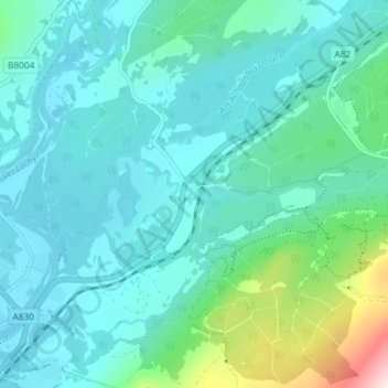
Name: Torlundy topographic map, elevation, terrain.
Location: Torlundy, Highland, Scotland, PH33 6SS, United Kingdom (56.82781 -5.06432 56.86781 -5.02432)
Average elevation: 90 m
Minimum elevation: 0 m
Maximum elevation: 548 m
Thank you for supporting this site ❤️
Make a donation
Make a donation
Gear up for your next adventure:
As an Amazon Associate, this site earns from qualifying purchases at no extra cost to you.